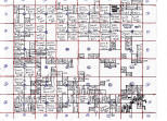
click on image for large view
Index to Audrain County Plat Maps
1838-1858.
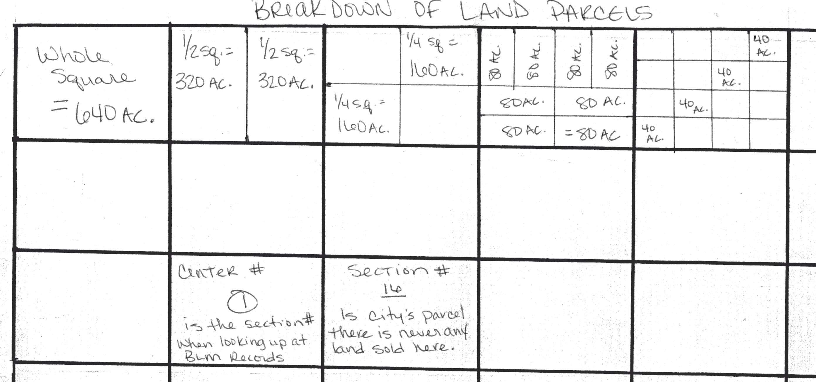
Breakdown of Acreage example
click on image for large view
Please note: this a large, wide file and requires side to side scrolling
| T52, R12W | T 52, R11W | T 52, R 10W | T 52,R 9 W | T 52, R8W | T52, R 7W | T52,R6W | T 52-R5W |
 |
|
|
|
|
|
|
|
| T51, R9W | T51, R9W | T51, R8W | T51, R7W | T 51, R6W | T51, R5W | ||
 |
 |
coming soon |
 |
 |
 |
||
| T50,R10W | T50, R9W | T50, R8W | T 50, R7W | ||||
 |
 |
 |
 |
